Showing posts with label ROCKHOUNDING. Show all posts

Saturday, April 25, 2009

Arkansas Wavellite!


Through the Ozark mountains and into the Ouchitas- I went on a short crystal hunt south, in Arkansas..
The difference between the two mountain ranges is Awesome; the Ozarks are still pretty bald but only an hour south it seems everything is well into the greening process. There is a lot of sandstone and limestone near ponca, which hosted a boom of lead mining operations in the first years of the 1900's. To the south, Mt. Ida sits on an ancient disappeared salt marsh- the source for many of the Aluminum-Phosphate minerals I searched for on the trip. A quick stop near ponca- I checked up on the ol' lead mines I discovered last trip. Near the highway, a small series of century-old tailings-piles or "dumps" marks where I enter the woods- They kind of look like dunes- Limestone waste piles are white or grey and where they extracted the heaviest ore- in the form of valuable galena crystals- is red from a bit of sandstone that they dug into- both matrices are common in the region. The dumps hold lots of cool stuff- druzy, clear and smokey quartz, calcite, galena and some interesting marine fossils like thick crinoid stems and bivalves.The galena crystals appear as large metallic cubes- some are inches, and all have been dulled and darkened by years weathering and oxidation; beautiful crystals in their matrix are not uncommon in the less-hunted upper terraces of the dumps and mines. In the picture below are two of the pieces I found; both have multiple large and small lead-coloured cubes.

... I swung through Lost valley and visited the river- and the cows- on whatever highway that is.South on 7- and hwy27- I found myself camping near Crystal Vista just outside Mt Ida. It was a cool night... I think the early-morning low may have been just above freezing- It felt crisp only for a second while the sun rose- I packed the big camera bag and had a thing of apple cinnamon oatmeal to get me up the steep trail to crystal vista. Some darker clouds rolled on my ascent of Gardner; Lots of large dogwood blooms added a sense of the Ozarks. Most flowers were past their prime- rotting brown along the edge of each petal-
the flowering trees that I spotted along the highway, just south of 44 to state line yesterday, appeared much more fresh and vibrant. I dont think that Kansas City's dogwoods are blooming yet.
At the top of the mountain- amongst the walls and terraces of the old crystal mine- the clouds were (almost) threatening; They looked bad, but seemed to be doing nothing but passing by. I walked the perimeter of the eroded pit, and dug a few shallow holes to expose a handful of points a a small cluster with a cool magnesium inclusion; spent some minutes examining a crevasse in a far high wall and the morning was over pretty quick. I drove a bit down the road and made a right turn onto a worn gravel road. It led me all the way to my wavellite hole in the County Quarry. - I scouted some nearby rock with a knife and a crowbar to find a wonderful patch of bright green variscite and a few tiny, fiberous cones of burnt-orange cacoxenite or wavellite..
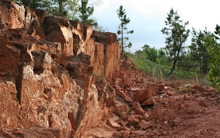
The famed Mauldin Mountain locality is currently closed to collecting, but several local miners and business owners have recommended parking down the street and walking in; apparently nobody really minds! I made my presence obvious to several machine operators in the quarry and only got a few friendly waves.
My original hole yielded some brilliant green wavellite crystals- they grow as the small partial-spheres or botryoidal masses and some are very lustrous and colourful. The darkest of the crystals are my favorite- like a deep emerald-green. Some darker clouds continued to sweep the sky and cast shadows on the Ouchita's- the day grew warm and pleasant. A late-afternoon meal at 'Ida's gas station and a pit-stop near the flooded river and I was off on 27. The fields around I-40 were smothered in yellow and wine-coloured clovers grew in patches along my route throughout the state. The warm air followed me home and it was surprisingly comfortable every time I got out of the car!

Monday, March 30, 2009

Ghost Town, Ark


"The Ghost town of Rush stands as a mute testimony to the activity of a bygone era.
Zinc carbonate ores were discovered in (the) valley in the late 1890's and the "rush" was on. Soon the hillsides were dotted with mines- sprouting colourful names such as Morning Star, White Eagle, Monte Cristo, Red Cloud, Buelah, Macintosh, Edith and Yellow Rose."

The town is fascinating- but for only a quick moment. A short row of four or five buildings awaits the visitor in the remote Ozark valley of rush. Only a few miles from Hwy 14- this side trip is well worth the left turn from Caney. The Buffalo is in early spring now- Redbuds and anemone's make for a pleasant break from Kansas City's latest bout of winter. The river, in Rush valley, is much larger than the Buffalo I know in Ponca. Still, it is beautiful and clean-looking. A slight green, milky colour today- some good rains lately. The river was the first thing I visited on my trip to Rush. I came to see the mines and did not know that the river was here!
I arrived far too late to brave the unfamiliar trails above the river a spent a sunny, pleasant afternoon by the river. Everything seems pretty soaked and soggy, but a tarp was enough to keep my tent dry on a high-spot of the washed-out campground.
The birds were goin'- it was nice to hear them after the silent winter months. They shouted MORNING, but the smooth walls of the tent were not light enough. My pillow was moist-going on damp, and the bag was wet...
I wanted to believe that the birds were wrong- and that I had time to roll over and space out for a while longer- but a cold, wet sleeping-bag was a miserable thing that I could not ignore. The zipper gave the usual struggle and the bag peeled off of me- I guess that I was already cold enough and the chilly air offered no surprise. I wondered if the grounds had flooded- things were a bit too wet for me to assume that a nightly dew was responsible. Had the river come over it's banks? Had it rained enough to overcome my shallow island?
Sure enough- it was the dew; a thick, slow-rolling fog dominated the valley. It was at first a bit disappointing- and truly weird to feel a light breeze accompany such a stagnant visual. A few finch-things livened up the river-side of my camp, but things were otherwise very still-looking.

I spent a few moments walking the bank of the Buffalo and then cut up a small, flowing stream. It didn't seem like I would see the sun today.
The low bridge leading into the NPS campground had flooded overnight- not threateningly so, but enough to send a loud, shattering wall of water over the top of the truck when I drove over. The flooded portion of the road was dry last night- it was very swift over the road, but covered only fifteen feet or so of road.
I rolled back towards the little town and walked around the few buildings. The dawn's thick clouds have certainly transformed the abandon, rotting buildings! I think it adds something to the sense of dead I found in the town- like it made the ghost-town even ghostlier. The top photo is of the post office/general store as it stood and functioned until only a half-century ago.The trail was short and easy- the old mines and relics of sorts lined every inch. An old ore cart lies off one side of the trail.. stiffened by rust and protected by the high wall that it served to create. Ore tracks- complete with mini-railroad-spikes- were abundant. These too were dying.
I explored around some of the old mine deposits- small bits of lustrous sphalerite were everywhere. Miners called this "Rosin Jack" and relied on it after the depletion of richer Smithsonite ores. Smithsonite was not too hard to find either- "turkey fat" was the name given to the bright yellow, bubbly, fatty-looking zinc crystals. One excellent vein runs down the wall of a bus-sized boulder up-hill of the largest mill.
Rush is a National Parks area though- and it is illegal to enter mines or to collect any of the gravel-sized bits of zinc or laying around. Signs that read DANGER KEEP OUT were posted in front of several mines that'd been gated or locked for the protection of visitors and bats alike. Up and down the hill here- and even across the river- there are many smaller digs and tunnels from early mining operations. The larger ones are big enough to walk in, and are blocked only where they have caved-in on themselves. Cave-ins were a scary part of Rush's history, and occurred more frequently when sophisticated blasting and drilling techniques were introduced to the valley shortly after WWI started. Such things became necessary when miners were forced to dig deeper into the mountain to fetch the ores.
I spent hours pacing the areas above and below the mines- crystals, minerals, old mining equiptment- it was all to be found. An ancient coke bottle and a HUGE platte of druzy quartz were my most memorable finds...
The fog lifted by mid-afternoon, but the sun remained hidden.. High clouds turned into stormy ones and the long ride from rush was gifted with all sorts of wonderful weather happenings...
Awsome clouds over the boston mountains and a thin, twisting rope tornado that never made it all the way... It rained for some hours and the sun set just as the back-end of the storm system glided past. .. rainbows came and went (had a triple going for a second!!!)... the winds picked up with a vengence and I rode a heavy tailwind all the way home-
It just dont get much better...

Sunday, February 1, 2009

DayTrip: Kansas


My mother and I took advantage of the stunning day yesterday with a last-minute adventure westward. It was forecast to be in the mid-60's and sunny! !
My mother wanted to go to the Konza Prairie, near Manhattan, and I had a few side-trips in mind. Black smoke billowed over I-70 in Topeka; smelled like a building fire- like plastic and treated wood. We exited on hwy 4.
I'd read about a spot to collect invertebrate fossils Northeast of town- where the hwy passes under Hwy24. The directions, from a KGS article on the spot, told us to pass the first ramp and hit a dirt road on the right before we passed under the bridge.
The spot was great! The fossils and rocks were pouring out of the shale and limestone- It is very similar to the fireman's memorial in Kansas City. We spent an hour or so collecting all sorts of reef-type critters; corals and sponges, chrinoids and handfuls of brachiopods and bivalves. No trilobite, but this one is something that is rarely found in Kansas. Many of the fossils had wonderful details like scars ans spines- they've eroded so well from the soft grey matrix that even the hollow spines on the two shells below were clean and clear of any mud. Gorgeous! The ones that were only partially exposed were just as detailed as he loose ones- sometimes scooped out and polished and apparently set on the rock, but still attached. The erosion here is truly art! I placed two of the shells which had good texture on my leg for a photo- what a cool spot! Mom liked the tiniest ones best, but I couldn't get enough of those with so much detail! We never fount the deposit of coal here, or the pyratized wood. Still so worth it! We hopped on Seventy for another while and found ourselves on 177 in no time! I got a kick out of the giant, ugly, 'WELCOME TO THE FLINT HILLS" which is written on a giant slab of limestone above I-70, though I know Ive seen it before. We had to turn around to catch our 'exit.'- McDowell Creek rd- And paralleled the Kaw for several minutes. The river seemed so blue- a great difference from the muddy, frozen Kansas River which we passed and crossed a few times coming from the city.
Konza's small gravel parking area was packed- dozens of other vehicles carrying people enjoying the same great weather! The hills around us- the flint hills- were very impressive! The topography was a surprise to me- Ive never really seen them other than the few times Ive driven the interstate.
The grass was endless- an infinity interrupted only by the occasional woody draw.
The backside of the parking lot was full of trees- many cedars, elms, oaks... One short, gnarly one could have been over four feet in diameter- there for hundreds of years, Im sure. One of the TRAIL signs was leaned against one of the trees- several more signs lay horizontal and beaten.
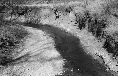
The woods were most dense near the windy creek, which we crossed twice on a pair of thin wooden bridges. The sides of the creek were very eroded- the gravel was flint and limestone and the water was crystal-clear.
Then we found the prairie- The trees stopped and the grass started and we were back on the surface of a vast ocean of grass. Each and every inch of it was full of detail- I cannot imagine what the place is like in the summer- Big and lively I would assume- It should certainly make a good trip when we find that season.
Lots and lots of native tallgrasses, but not too much else. we passed though a cluster of dried, brown compass-plants on the way up to the 'radio tower' summit. Such structures are the only things interrupting the view behind the hill- from our side, there are many miles of flat farmland visible.
There were many people on the trails- you could see them crawling all over the hills, which resemble the more familiar loess hills in size and steepness.
At the top of the 'mountain' was a spectacular view and an incredible wind- the wind started started when we got about three-quarters up- blowing at a constant 20mph-
at least strong enough to make you remember your hat and jacket. ...
I caught a few people-less panoramas with the 35mm, but the stream of people was hard to work around. The crowds certainly put a damper on our visit, but the area was top of the hill was well worth it!
The windy walk back was a short, beautiful 1.2miles through the same prairie and into a long woody draw. The people were thick near the old homestead. I was tempted to confiscate one of the many fallen, bent and scratched trail signs, but I re-planted a few instead. Maybe next time.
We headed back towards Manhattan and made a couple of quick stops on and over the Kaw for pictures and a 'walk on the beach.'
The large sandbar under hwy 177 is smothered in footprints; 'Cant imagine that the thing hasn't been picked clean of all of the nicest artifacts, but I sure hoped for an arrowhead- Ive only ever found two!
CLOSE ENOUGH! A small shard of pottery.
We gathered up some shards of bones and the fossilized lower jaw from a small deer or something. Some other dark, rusty-coloured bones like a large pelvis and a pair of vertebra were newer- only starting the process of river-aging. The wind was even stronger here- gusts strong enough to force me a step or two sideways or backwards. My mother was often turned from the wind and ducking from the painful clouds of swift sand that constanly pelted and tore at us. I put some extra effort into gaurding the cameras, but the wind worked the sand into every crack. The clouds of sand snaked down the long gravelbar like those wierd lines of snow on the road- and went many feet into the air- I imagine that even the cars on the bridge far above us and dowstream felt some of it.
Finally, a quick run up the east side of Tuttle Creek Reservoir to check out a volcanic Kimberlite formation that I'd read about in another KansasGeologicalSurvey report. The lake was pretty cool- off of the dirt road were rows of harvested corn that stretched to the shore. It made for some nice photographs, but I cant imagine that its any good for the water quality of the lake.
an increase in the turbidity of the water, from adding a fine sediment like cropped dirt, would have a negative impact on the amount of Dissolved Oxygen that fish and invertebrates can use and the amount of sunlight that aquatic-thingies use to decompose matter on the bottom. Somehow, its sure that all aspects of the under-water environments and communities will be influenced by the additional sediments alone. Who knows what kind of chemicals are being spilled into the lake because of the farming!? The poorer water-quality of Lake water is not limited to the Lake, either.
The poor lake-water is sent downstream, eventually landing in the Kansas River, the Missouri and the Mississippi! (Never did find the kimberlite...)

Thursday, January 15, 2009

KC Plant Fossils!?

My Super-secret sandstone fossil spot on a BlueSprings hwy! Shared with me years ago by a very generous Jackson County person, and now visited only very rarely. The golden and tan-coloured sandstone hosts a great variety of plant fossils. Most are different sizes and shapes of ferns, but the rocky remains of the leaves of other similar things, including trees and shrubs are to be found here.

My Visit was a bit nippy for any real collecting, but it was cool to dig through the loose stuff while fescue is thin (relatively) and the Sericea is under winter's control. Today I found several exciting stems of ferns some softer stems and larger broad-leaves. Most of the rough plates are void of such impressions, or display only a few with little contrast, but chipping the edge of a rock here will likely reveal something good that would have been missed otherwise. My favorite was a small fern's. It is not as defined as many that I discovered, but has a very pleasant, natural shape/curve. The tip's still partially covered- this makes for a cool effect! The set of leaves is the only one on the large sandstone block, and is ~two inches in length. COOL!

Saturday, January 3, 2009

Swope Park FOSSILS

What a beautiful day! Even the bugs thought so; this ladybug enjoyed our 50+degrees at the fireman's memorial where I stopped for a bit of fossil hunting. He wasn't slow, either- the little thing sure didn't want to stop for a photo. He'll be something of a bug-cicle by tomorrow!
I started out on the lip of the second terrace, in between the black shale and edge of the rock where the best fossil-bearing limestone is exposed and eroding. Here, I found all sorts of bryozoa and shells. The wind blew my collection-bag over the edge and I jumped down to retrieve it. On the base of the memorial there are few fossils. Some cool iron deposits. I was lucky enough to come upon some odd calcite crystals and a patch of rainbow-coloured pyrite- the crystals of both minerals are small, though.
I returned to the lip of the bench for oodles of coral-like bryozoa skeletons, detailed shells and small crinoid parts. The trunk segments of the crinoids were most common, but I managed to gather some very cool spines and even a few parts of the flower-like head. Some of the shells I found show remarkable detail. Many are broken or fractured and still on the limestone matrix, but there were several today that were completely eroded from anything and still in fine condition- like they'd been taken from some shallow sea and placed on the bluff just for me!


I moved onto the next bench after an hour or so, where there were many handfuls of larger, clean-looking crinoid segments waiting in a thin, wet vein of soft material running at shoulder height. The vein runs the length of the memorial, but the echinoderms are so abundant in only the far 1/3. Here, also, there are few other fossils. the kinds of things that are found only about twenty feet below, on another terrace, are completely absent from this layer. All of those cool shells and coral-things are below. Crinoids are up on the higher level- and larger pieces are not uncommon!
I did manage to spot a very cool scallop-like shell fossil in the dormant vegetation. The coolest part of this matchbox-sized fossil is that is still shows some of the colour and patterns of the shell. I think that it was THE SCORE for the day!ABOVE are more of the common shells from the lower levels of the memorial. This beautiful trio has been only partially weathered from it's matrix- Such fossils are easy to collect here. I think that these are some kind of Meekella; the remains of one of dozens of species of Brachiopods existing in the deposits at the memorial. Found some cool shelf-type fungi on the the way out...

Thursday, January 1, 2009

Two days of Awesome!

A day of driving- I cut through the tornado wasteland south of Joplin and through many of hwy 90's best little towns. A town of three churches and a one-room school building. A graveyard with only one rule: "Please contact board member before opening graves." And, of coarse, plenty of roosters and goats!

I drove through Ponca in search of some old lead mines north of town. Several websites tell about the mines and describe an abundance of good minerals- I couldnt find it. Stopped in Ponca's one store and asked one of the women behind the counter for directions.
She joked about similar inquiries and told me that the mines were on property that was owned by a tucson man. They are not marked for NO TRESPASSING, but she did not want me visiting the mines because of the danger there.
I visited nearby Lost Valley before leaving the area- it is where I planned to spend the night after visiting the lead mines. The area was flooded with people- guess a 70-degree day was a good one to spend here! Wondered through the ancient cabin on the property- I LOVE this old home. I noticed the lack of elk on the way out- this is my first visit with no elk!
The old cabin, near ponca, is on Federal land. There is a door, a stove, a single boot and the last shreds of wallpaper still in the cabin, but thats all. It stands only with the help of a pair of new support cables, but still seems to be falling over and apart. The boot has moved since I last saw it.


Wegner's Quartz mine on Owley rd, south of Mt ida, has an incredible collection of crystals from it's own property and around the world. I took a trio of clusters from the outside-tables and paid only $1.40 for them. The shop charges by the pound! One of the clusters is smothered by the mine's famous Magnesium "blue phantoms."
The crystals on the tables below are offered by Matt Price, Owner/Operator of the Arrowhead mine. The clusters and points are pricey, but Ive never seen such quality! The pieces are flawless-even the largest clusters!
Stopped by "Gee and Dee's" on brewster mountain. Dolores (Dee) is a kind woman. We yaked for an hour or so- Gee has been working in the mine for 49 years now! She told a story about a cop inspecting Gee's crystal-cleaning chemicals as illegal drugs and stubbed her toe in between two rows or crystal-topped tabled. "See that!?" she said. "That's the lord, there, punishin' me fer my sassy mouth!" THE LORD is involved in every few sentences and she speaks with a heavy country accent. I spent a coupla bucks and took a few points, several small clusters and a double-terminated wand with a faint phantom. Dee was sure to give a reciept for the Oxalic acid she sold me to prevent any unnecessary problems with the police. I dug on their mountain for a morning- its a nice spot, but the small crystals are a lot of work!
I came from an afternoon at the Arrowhead with a five-gallon bucket of rough material and a few larger plates of clear quartz. Even claimed a few of Matt's pieces- I bought a pair of hand-sized haystacks and a few large points for far less than he would have charged if the crystals were cleaned. I will clean only a few of them- the rainbow rust can be beautiful!
I found a wonderful church on 27, north of Mt Ida. Took some photos and explored around it. Turns out it was Montgomery County's own Sweet home church! I had to do some extra research on it, but Ive discovered a very cool story behind it.

The SWEET HOME Church existed long before the huge neighboring Lake Ouachita. Land was donated by the Hovell family when the need was realized; Hovell moved to the area in 1905 and decided that the school house which hosted their Christian Services was insufficient.
The church was built by Hovell and his friends and family with available lumber. Shingles for the roof were split by S.J. McCullar and David Music. Of all who helped to build the church, only Ed Benson and Hovell's son are alive today. The Sweet home Chirch was dedicated on May 17, 1908 when Dr. G.E. Cunningham, a Little Rock minister made the building's first sermon. The text was Luke 7:5 -For He so loved our people, He built them a synagogue.- He said it could be aptly paraphrased -For they so loved their people, they built for them a church-
Most of the homesteads were sold to the Caddo River Lumber Co. and the owners moved away. Hovell jr. moved to Norman, Ark. and services were not held at the church for several years. He moved back into the area in 1929. While in Norman, he developed a friendship with Dr. John Barr and persuaded him to preach and organize a church in the Sweet home building.
I searched for Wavellite at the huge County quarry, also known as Mauldin Mountain, and I thought I had collected some. It was Matt from Arrowhead who directed me here. Turns out it was brightly-coloured Planerite in unusually well-formed balls- it usually grows in yellow and green films on the host rock. I found this growth, too. Pretty, though!

(CLICK ON ABOVE PHOTO FOR COOL CLOSE-UP!)
Huge Clusters, and smaller, perfect examples of Arkansas quartz can be found on display and for sale at any of the area's mines. Gee and Dee's were of a poor quality compared to Arrowheads' and Wegners limited supply also seemed damaged and milky. Maybe I am just spoiled?
No matter what, it seems that you will get what you pay for here. The finest quartz is priced at near $100/lb and phantoms, inclusions and manifestations are always worth a bit more. Size matters, too; a larger cluster of crystals that are of equal quality to those of a smaller cluster will sell for more $ per pound. It works out for me, though- those clusters that are less than a few inches in diameter are my favorite. Clusters this size are easy to collect and are often more complex than larger ones.
WHAT A GORGEOUS DAY Monday! The air is so warm- even the spring peepers are out. I imagine they will be turned to frogcicles by the end of the week, but their screams put spring in the air!
Arrowhead mine- Sunny this time! Had a long conversation with the mines manager, Brian. We shared stories of collecting and some of our favorite spots. I learned a lot about the process of local mining. Thanks brian!