
 I stopped at the south end of South Park for a stretch and my third soda- 'been sittin' ever since I left shadowcliff, several hours ago. Id come south on hwy nine-Over I-70, past the 'haircut store' and that liquor store with it's signs and ads hung crooked and upside-down. I drove right through the ALMA mining district that Id read of.
Hartzel; The tiny historic town sits right on the edge of the giant, flat South Park, and still is surrounded by many peaks exceeding 12,000 feet. The old jail building made for some cool photos; I walked through town, past all seven colourful buildings, and continued into the park.
Antelope, donkeys, lots of highway patrol SUV's... I passed a pair of crows gnawing on a red skeleton only meters off the road. The scene seemed appropriate for the flat nothing that was south park.
I stopped at the beginning of the ascent that was Wilkerson Pass for a photo. Ive heard many stories from the locals about the great stones that are to be collected on the pass- giant green tourmaline's, long smokey quartz points and cubic iron crystals. Ive not tried searching the area... Maybe next trip.
The real trouble began when I was faced with the decision of which rock-spot to start at when I reached the little town of Lake George-
You know your close when you pass the Lake George Bible School on hwy 24- thats about the time when I decided to continue past the campground and strait on to my Amazonite prospect. I passed through town- it was just about dinner time and the Pizza joint was packed.
I found my Amazonite holes at the beginning of National Forest at the far end of town. I dug for a quick second and became intimidated by all of the loose material I was moving. There was plenty of such material already laid and cleaned with rain- I resorted to scavenging the tailings of existing holes.
Amazonite grows in veins of loose, blocky material through the hard granite. The veins are called pegmatites- coarse igneous rock with grains at least 2cm. Most pegmatites, including the ones around Lake George, are simply coarse granites- composed of quartz, mica and feldspar and hosting a range of exciting minerals and crystals. Amazonite itself is a type of feldspar. The mineral was once considered only to exist in a few spots in the llmen Mountains of Russia and was named after similar green stones found near the Amazon River. It is not known to exist near the river.
Today, two locations in Colorado: Lake George and Pikes peak, The Llmen Mountains and a possible locality in western Montana are the only places where the mineral is known to occur. It is highly valued as a gemstone- blues, greens, and sometimes red in the lower quality crystals. Amazonite is commonly found crystallized with Smokey Quartz.

I found no crystals. A single large, blueish hunk of it was the best that I got- Im certainly not complaining! The large piece is about .5 x 1.5 x .25 inches and shows some brilliant blue-green colour! It laid unexposed under a stack of pine debris.
'stole a handful of small quartz points, to; none of the points showed too much colour.
The sun was low when I got back to the truck- I had the treasure wrapped in an extra t-shirt. It was right at the point where I was getting the last of the warmest direct heat; The sky was a light gold.
Got my truck out of it's dodgy parking spot and scooted up County road 77 on the other side of the pizza place. Sixteen miles later I arrived at the Spruce Grove campground. It is a National forest one- I paid my $12 and had enough light to set up my little tent and heat up a can of soup. It was very dark when I crawled into the sleeping bag- It was going to frost, you could smell it in the air. No moon.
The morning yielded much Frost, hot chocolate. I started up the trail from the campground before the sun had a chance to peak over the mountains. There is said to be large topaz at the old claim up there- blue and sherry gems as big as your hand.
The sun caught up to me as I passed through a small aspen grove- it sprayed the golds and oranges and reds all over.
I dug... and I dug... and I dug. .. I spent an hour or so searching through the tailings of other's holes and left the cold claim empty-handed.
The bright trees were even brighter on my decent. I had not noticed them last night; The aspens were everywhere!
Descending..... and the aspens are yellow and the sun was up! I was just starting to feel the icy crisp fall out of the air, off of my skin, when I prepared another steel mug of hot cocoa. The stuff was soul-warming and only complimented the warmth of that blinding morning sun. If the sun emitted no heat, the bright light on this chilly morning could have been enough to warm you!
The frost began to retreat, though it stuck thick in the shadows.
I stripped my feet of boots and so many socks, and I changed into a pair of jeans from my warm, cushy fleece. I jogged over the sharp, icy rocks and snatched up my gold pan and a water bottle.
A film of ice rolled around the top of the bottle as I jogged over the wood bridge and down Tarryall creek. I hoped in the numbing water and scooped half-a-dozen pans out of the shifty gravels behind a few boulders in the shadowed shut-ins.
The pans yielded about two hundred beautiful pomegranate-red garnets. Each one was had been cut and polished as if by some wise lapidary and none were larger than two carats or so- they'd been worked simply by the rushing creek. I knew of the garnets from my last venture to the Spruce Grove Campground, and of the gold that is said to hide in large nuggets throughout the shut-ins. There was no gold in the heaviest material of my pans- though I did get a few slivers of some light-coloured metal.. .Silver ? Lead?
I took a photo of one of the most productive pans and gathered a few dozen of the largest stones... enough to fill a glass vial, as requested, for a friend.
 It was about the time when my feet, ankles and calf-muscles were starting to scream when I jumped out of the creek. The sun had made it's way into the small canyon and had shown on me for the last two or three pans.
My legs hurt worse as I walked and warmed up. ... so worth it!
Im sure I looked good walking back.. My jeans are rolled up and my two thick jackets exaggerated my chest and shoulders.. like something in between Huck-Finn and Sasquatch.. COOL!
The camp was just about dry- my phone said 10am. ... I waited another half-hour for the last of the melted dew to roll off the side of the tent. I packed up and decided to try my luck with the amazonite before I left town for the last time this trip.
Up county road 94 and past the NFS building. I stuffed a pair of orange pill-bottles into my pockets and grabbed a small hand shovel. It wasn't until I reached behind my seat that I realized that I'd left my favorite hand-trowel at the topaz claim this morning. Oh well- the thing was nearing the end of it's life anyway. A broken tip and a bent, loose handle was not worth the tip back (though my favorite trowel was... almost...)
I walked down the road this time- I did not bush-wack up the hill like I had on all of my previous trips. The road was #205- not a road any longer. It's been blocked off and converted to a hiking trail.
The first hole I found filled up a bottle and half of another. It was not just Amazonite, either. I found Amethyst and smokey quartz... clear points, too!
I collected a tiny cluster of amazonite crystals, two large hunks, and a half-shovel full of chips and points at the next hole, only twenty feet down the path! The two larger pieces were about half the size of my hand and were simply pegmatite with a bunch of green and blue pieces growing out of them...
I took a photo of the shovel full of chips and stashed them in my comfy wool cap. I topped off the second pill-vial with a handful of other holes, but nothing compared to the first two discoveries. It was about noon when I crossed over Wilkerson pass again. I did not stop, despite the temptation.
I did not know where I was going, though I drove like I did. I knew that it was 27 miles from Lake george to Hartsel- to the sign that would tell me how far I needed to drive to Buena Vista. I knew that I wanted to go south, and of a mine I wanted to visit in Northern New Mexico.
The truck grew thirsty and I filled up in Buena Vista. The town was surprisingly large, though I realized quickly that about half of the city was, or appeared to be the county's "correctional facility"
I glanced at my folder full of Internet print-outs. "Ruby Mountain..."
"... six miles south of Buena Vista...east on County road 47..."
...that was all I needed to read. I knew where I was headed!
I spotted the Nathrop general Store on my right and knew that I had gone too far. I turned around at the other building in Nathrop, the post office, and was headed north to find this County road 301.
I got 1.5 miles from Nathrop- another .4 and I would surly be 6 miles south of Buena Vista. A sign read Ruby Mountain, Co.rd 301/301A. I followed East onto a skinny dirt road and checked my internet directions. ..."cross the Arkansas river..." I did that, or I guess, I crossed some kinda river!
I pulled into the Ruby Mountain state Recreation area and stopped at another one of those silly fee posts. I gave them my six dollars and continued with my papers.
"crystals of spessartite garnet, yellow topaz and obsidian in perlite...Garnet and topaz specimens can be found by sorting the talus rock at the base of the cliffs. Climb Ruby Mountain from the northeast side."
I located Ruby Mountain itself- a large, isolated peak at the far end of the park. Again, I pocketed some collecting bottles and slipped a small, deformed crow-bar through my belt loop. I think that I began on the southeast side. About half-way up all of my scurrying came to a halt when I spotted a pile of shiny beads spilling out of a crevasse in the perlite. I grabbed two of them, despite their resemblance to rat droppings- all I could without allowing myself to slip down the loose slope.
I held two obsidian balls in my right hand- Apache tears!!!! The black glass eroded from the shiny grey matrix that I stood on- It must be the the paper was talkin' about!!
The thought of collecting obsidian was too cool! I filled up both bottles with the little riches and made my way over each crevasse as a hungry squirrel would have in search of acorns. The gens were just about as common as acorns, too! Once I recognized what I was looking for, the things were everywhere!
The glassy pellets could be rolled out of the loose perlite by the millions! I had turned to my pockets by the time I reached a flat spot, about 3/4 up the steep hill. I took a photo and took a second to soak in the huge view. I noticed a light-coloured deposit below me, on the eastern side of the mountain.
 I descended the hill- down until I stood atop the massive, white, chalky deposit I'd seen from above. The stuff had the texture of sheetrock- I cant imagine that it was anything but chalk.
I searched through the material until I, myself, was as white a the ground- as white as an eggshell. No garnets, No topaz.
I dusted off and hopped into the truck. I wanted to find a spot to camp closer to Mt. Antero. I found a closed rock shop, Mt Antero, and a whole bunch of Shut-down campgrounds. It was a very nice drive though- the clouds marbled the sky so that there were all shades and colors mushed together over the towering 14er's across the valley.
I returned to Ruby Mountain and claimed a camping spot before starting up again... this time I was going to make it to the top !
The mountain was shaded with the new cloud-cover and the sun was getting low. I scrambled up the side- scooping obsidian as I went. I got to the flat spot that I had reached a few hours ago and continued uphill. There was no trail- Not even the path of a deer on Ruby Mountain. I spotted a very large Apache tear and reached for it. OUCH!
My hand was full of painful cactus quills! They were brown and yellow and so numerous and small that I could only remove a few from my swelling knuckles.
I got the stone on a second attempt.,
At the top there were few obsidian stones. The rock was a much lighter grey and had a sharp, talus texture. I sorted through the smaller stones and found no garnets or topaz. I examined a larger one- about the size of my head. I skimmed over every mm of the rock and found nothing..
...Until I flipped it to it's only unseen side. ANOTHER EXCITING DISCOVERY!; three little garnet crystals!
The little red gems were about the size and colour of the polished guys I'd stolen from Tarryall creek. .. These had faces... each little crystal- two standing off of the surface and a third growing larger out of a gas-crack- had many facets and faces so that they were round, but checkered like a soccer ball.
I found several similar stones in the following minutes, and held onto them until I started finding similar crystals on smaller, more manageable chunks of the light ryholite.
I slid down the loose perlite of Ruby Mountain with a pocket full of Apache tears and three hunks of Ruby Mountain with seven 'rubies.' I got to the bottom and glanced back at the mountain to fond some very cool clouds and lighting. I jogged back to the truck and the campground to retrieve my camera. .. Mt Antero and it's comrades were also very beautiful in this special evening light. Sunset was pretty spectacular!
Camping at Ruby Mountain is pretty open, nasty. The campground was the most expensive that Ive occupied since Arkansas state parks, and really wasnt too nice.
AGAIN WITH THE FROST! My toes were numb, as usual, when I woke up- I downed a dish of oatmeal and started off from my tent. A giant toadstool rock stood on the north side of the campground, in between me and another rhyolite cliff.
"No Trespassing" was what I found when I finally reached my destination... I turned back for Ruby.
I returned to my thawed, dried camp with a handful of beautiful garnets at about 10am..
 South of Nathrop is county road 162. I followed it west.
The directions on another print-out led me 16 miles west of Nathrop to a fork in the road, and another 3 miles south of the Ghost town of St Elmo. The gulch I'd driven into was smothered in changing aspens. I was pinched in between the steep slopes of two of Colorado's most famous 14,000-foot mountain peaks, Antero and Princeton. I drove three miles south on the narrow, sketchy dirt road before I saw what I was looking for..
The St Elmo Gold mine stood far above me. I had to put it into reverse for about 1/2 mile- there was nowhere to turn around. The old mine building stood sturdy in back of tons of fine tailings.
The Mary Murphy Vein, discovered in 1870, was rich with metal sulfides. Its discovery was responsible for the Mary Murphy Mine and six others in the surrounding area. The Mary Murphy produced continuously until '26 and generated over $25M in Gold, Silver, Lead and Zinc.
It is said that on it's dumps one can find fine specimens of minerals such as smithsonite, cerrusite, pyrite, chalcopyrite, galena, sphalerite, rhodonite, quartz, and one that I was particularly excited to hunt for, Rhodochrosite.
My guide did not give any specific localities to the mines, only that they were about three miles up Co. rd 295- I was there, and that dark structure above me sure looked like a mine !
I climbed the tallest dump and made my way up to the building. I only skimmed the dump- found some good hunks of glossy coal and slag. I saw no signs that I was trespassing, though for all of the gates I had to maneuver around, I had to be.
The big, creepy building was just about hollow on the inside; My flashlight exposed only a material shoot and a maze of the building's thick framework.
I got down to take a closer look at the things I was walking on. Immediately, I identified a big, shiny piece of Pyrite.. COOL! I set the rock next to my camera on a wood plank in front of the door. Soon I had a handful of pyrite, galena, and a special surprise, blue chalcopyrite.
The place clouded up and the dark, creepy building only got darker and creepier.
I kept searching. A million little epidote crystals. They were much prettier than the massive epidote I'd broken from the granite near Grand Lake... , same range of colours. I got a nice block of heavy galena. It is matted (should be metallic-looking), but it is still very cool. I searched until about 2p- I covered the entire dumps fairly well. .. definitely had the best luck under the legs of the airrail(what was left of it), and immediately in front of the building- the downhill side.
I took a quick second to follow the rail up the hill- I was hoping to find the old shaft, but it had been sealed up. .. I crawled down to the building and it began to rain. The upper part of the building was pretty cool-looking !
There was a giant enrance for the carts to dump material, and a funnel the size of my room. A huge series of gears- some more than three feet in diameter, - seemed to have ran the whole operation.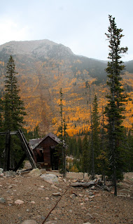 The rain slowed to a sprinkle by the time I returned to my truck. I drove back towards Nathrop... The roa d was getting nasty and Shadowcliff's computers may well have been the weight that I needed to retain traction. 'Certainly didnt want to be stuck out there- twenty miles from a nothing of a town, in between a creepy ghost town and a creepy ghost-mining operation!
I stopped at the Baldwin creek Jeep trail- about 13 miles from Nathrop. I got this silly idea in my head that I wanted to start climbing the killer mountain tonight!
My truck, despite all of that rock and those computers, would never be able to climb some of the obsticles I saw in only the first tenth of a mile !
I packed my tent and bag, a stove and fuel, a few cans of food, etc.. into my pack. It weighed about twenty pounds.. It was a last minute decision to wait until tomorrow. I threw the ready pack into the bed of my truck and continued towards NAthrop... It was time to find a campsite.
There it was! I pulled the truck through a deep mud pit and onto a wide, dry gravel parkinglot. I walked to the end of the parkinglot and spotted an open space far behind the "no camping" signs.
I grabbed my pack and set up- not too far from the tuck.
My tent was up, my stove was roaring and then I saw something at the furthest point of the giant, flat, rectangular open space- It was the standing remains of an old, burnt chimney!
The beautiful, disturbing thing stood about ten feet high and though it was fairly intact, was barely recognizable in the cloudy dusk. The lighting was that of a full-moon's and upon examining the rest of the area, the chimeny seemed to be the only obvious mark of a house.
It was creepy, though not as much as the big mine.
My dinner was boiling over, but I took advantage of the last few moments of light to gather wood.
WHAT else are you going to do with a Chimney!!!??
I cleared the area around the chimney and livened the house up with a bright danceing flame!
The fire seemed to warm the entire are up pretty well, and sure helped to extinguish the creepy factor..!
The mountains above me got dark fast! I watched the fire until I was convinced it posed no danger and retreated to my tent. The place grew black and then all those normal sounds of night began sounding off- I was a bit jumpy this night!
The creek that rushed behind the smouldering chimney deafened me to the softer sounds, but the occational snapped branch or screaming something gave me a bit of awake!
I was surprised at how warm I felt when I woke in the morning- there was a thin shield of ice on things like everyday, but the air lacked that sharp frozen sting. The sky was just getting that pre-dawn glow when I took the tent down.. The birds started up.
I threw everything- waded and still wet or frosty- into the cab of my truck; There was no time for unnecessary drying or folding because I was going up the mountain. The pack weighed a good eight pounds less without the tent or bag and the extra food. .. Just my collecting stuff, Some rain gear, the crowbar and a couple of litres of water.
I stopped at the trailhead for a glance at the map. It looked like I would need to take road 278 up the mountain- I was not real sure; the ink had run down so that it all looked like scribble.
I walked for hours- spent some time searching for a worthy walking stick, and some photographing a little waterfall thing uphill of the trail. I hoped for a passing jeep, but nothing ever passed. 
I marched up the mountain- three and a half miles passed before I saw evidence that I was on the right path. I reached Baldwin Creek- and another map.
The map pointed me left- I thought.
The road to the left looked like it would continue to climb; The one that went strait went to Baldwin lake, and I knew I didnt  want that one. I was ready to go; I'd made up my mind to continue to my left. The first step would be to cross baldwin creek. The water was crystal clear.. A short bath would have been tempting if it were not for the pretty ice crystals that decorated the space inbetween exposed stones on the edge.
The climbing continued to the tree line. I did not realize that Baldwin creek was only the half-way point!
The trail cut west and skimmed the trees for a while. It was when I began to climb again- right at the base of the forst set of switchbacks - that I heard an engine. I came from another trail.
The big white SUV thing rocked and rolled over a few boulders. It did not look like the kind of vehicle you'd expect to find on such a nasty trail !
I waved- the driver stared at me- or glared- from only thirty feet away.
He did not wave back.
Instead, the big nasty thing started up the switchbacks and left me to enjoy it's exhaust. The switchbacks were intimidating- only five or six big ones, but they appeared to lead to the peak FAR ABOVE ME.
I crawled up the first two and spotted the SUV turning the fifth one.. .I got half way up the third and saw the SUV at the top.
It seemed to take hours to complete the set of switchbacks- They were not too steep, but each one lasted for a longs way. I was catching my breathe when I got up on the ridge- a cool view of some Volcano-lookin' thing to the north, and Mt white to the South. You could see the roads and prospects ripped into Mt White. 
Antero Must have been hidden behind the smaller peak infront of me, 'cause I sure couldnt recognize it! I hoped Id taken the right trails!
The trail forked again; 278A went left and 278B split to the right and seemed to sink into a valley before ascending Mt White.
I was tempted to go up White- The gem fields seemed only to be a few more miles.
The sun was warm and bright- I sat for a second at the intersection of the trails- Took my gloves off and had a handful of peanuts.
Aquamarine was the purpose of this excursion. The light blue crystal is a rare type of beryl that is commonly faceted and used in Jewelery. Mt Antero, 14,269ft has been one of the most productive locations in the world for the gems; The mountain is Colorado's tenth highest and hosts the highest gem field in America (third highest in the world).
The left trail sounded okay; I began to climb another set of switchbacks. They took me up- the trail got narrow and steep.
I heard another engine revving above me. Then there was the screatching and screaming of tires. I saw the awkward white SUV coming back down the hill. I got up on the loose hillside above the trail- there was barely enough room for a car to come down, and a matter of inches would be enough to send an Suv rolling thousands of feet down the side of the Mountain.
I sat to wait for the thing to pass and began examinning the millions of loose pebbles at my feet. They were all rough and sharp; Most of it seemed to be a fine white granite. I searched through handfuls of material in the time it took the monster to make its way down to me. I found a small blue stone, though it certainly was no gem!
.... and a large Smokey Quartz point- this one was perfect! !! The SUV pulled infront of me and asked if I'd found anything. Two young guys-in their twenties. I felt the hot air steam out of the truck the second he unrolled his window.
'NOt yet" I told them, "You"?
They said they'd found nothing and I wished them good luck.
They continued down the road and I got back on my feet. It was only moments before I spotted a shiny something on the uphill side of the path. A small Aquamarine!!!
I picked the little thing up- only a cm long, and a cm wide; The clean crystal was flat and beautiful- more of a green than a blue.. I stashed it in my pack and continued eagerly up the trail.
A big dark katydid thing caught my attention. He hoped along the steep side of the one-lane path. How odd it was to find an insect in such frigid conditions!?
The clouds began to roll in thick and I could no longer rely on the smooth sufaces of any crystals to reflect their rescue beakons. It was up to color now. I spotted a few spots of blue, and collected only traces of other crytals. the clouds wer thick by the time I got the the last switchback... It was quiet, though. THere was nothing but the big, dusty, grey mountain and me.
It was just about the middle of the final hairpin that I spotted another hunk of blue... This crystal was more like what I expected to find. Maybe a half-inch long and the deepest blue one could imagine in such a stone! The crystal's colour resembles that of the sky at dusk. BEAUTIFUL! The outside was scratched and matted- It lacks that vitreous sheen that made the smaller one so special.
I would love to send it off for faceting, but Im afraid it's got too many fractures inside. ... maybe!
I kept up the last stretch of climb and there was the roll of a distant thunder. The ground was grey, the sky was too.
Something caught my attention- it couldnt have been a crystal because whatever it was was too far away. Above me, and about fifty feet infront of me.
I couldnt believe what I saw!
The snow flurries started, but I was staring at a goat! The whole thing was very surreal.
The wind began to blow- it was cold!
There he was- a thing of legends and myths; The goats shaggy white mop swayed in the breeze, and he simply stood and watched. He was not alarmed, though I am sure he was as surprised to see me as I was to find him!
The snow flurries continued and the lightening started up again. It was closer this time.
A patch of sun lit up the top of White and the goat began to move. I slowly reached for my bag- unstrapped in with my right hand and brought it forward with my left. I held steady and as still as I could as not to alarm the beast. My camera was on the top- I lifted it slowly to my face.
I got a nice picture of the goats' butt as he walked away from me. I stood as he walked- He seemed to be headed up the little hill to my right.
The thunder clapped louder- maybe from that volcanic hill next to us.
The goat looked up and I snapped a photo of his smiley face.
The mountain goat is the largest species that lives above tree-line year-round. Both males and females have beards and long, skinny black horns. They are not actually goats, but related most to the extinct Ibex that roamed the ice ages long ago. They are classified in the same family as cattle. The wise-looking creature watched me for a few minutes as I searched for my crystals and summitted the cold, wet 13,800' peak next to antero. The lightening slowed up and the the snow grew even heavier.
The goat disappeared behind the dark, rocky hill he stood on just before I ducked below the peak infront of me. The weather was only getting worse and I was standing only a few hundred feet below the highest peak for miles!
I was not about to turn around, though; The way I came would take many hours to decend!
I hoped off of the edge of 13,800'- fell for many feet onto what I expected was a loose slope of the rough gravel.
That it was- I hit the ground softly and slid upright for ten feet or so before takeing another careless leap. I was halfway to the first set of switchbacks only ten minutes after I was at the peak, and I was feeling very comfortable with the slick slopes. My neck virbated.
And again- there was something vibrating softly, but violently on the back of my neck.
I took my pack off again; it had to be my phone !
I have not recieved a call on the thing for years, but it was definitly my phone!
I answered; I still slid down the gravel slope- like a slow-motion rockslide.
It was Libby- she wanted to know where I was. Gladly, I told her. The snow began to blow in a harsh Northerly wind that put a blizzard in my face. We spoke for only a few moments and Libby heard the threatening thunder over the phone. I asked to call her back- and I had a damn good excuse !
I packed up again. and got to my feet- Still, I slid.
The blizzard lasted for a few more minutes and I was only a few hundred yards from the highest switchback.
All of the weather stopped. It just stopped. The snow lasted until the wind stopped and the clouds dissappeared. It was sunny and calm again.
It was nasty and then it was beautiful; the change occured within a single minute. COOL!
So there I was- ontop of a slow rockslide ontop of the world!
I looked west to the storm that had attacked my mountain. It appeared very mild to one that was northeast of me. They were all dark spots on the mountains- so temporary.
I sat a second; No storms seemed to be threatening my mountain, and I took the moment to watch the world. Its a great place to do it!
Everything just did what it was going to do and I dont know why I got scared at the top- I was not going to be hurt. 
Another sparkly crystal was there, at my feet. I stretched to nab it from atop the white granite. This'n was long and skinny. a half inch or longer, and bright blue. The crystal was very colourful, though not nearly as intense as the larger one I'd recieved from the top of the mountain.
I stashed it in my left pocket. The remaining section of loose gravel was taken on my butt. I slid slowly down so that I could watch the ground for crystals. I found only one other, but lots of colourful, low-quality traces of them.
It felt wierd to stay still when I stood on the road. The world moved like it had on the slope, but I did not. Again, I sat and enjoyed the view for a few moments.
It took until no time to get down the switchbacks that had taken me forever to ascend just a few hours ago.
My pockets were filled with gems when I hit the bottom of the switchbacks. The trail smelled like fall. .. All of the piles of dead, dry leaves let off that aroma that can only be recognized and remembered when it is again encountered. I guess that it is the smell that you found on halloween night.. when you dressed up and ran around collecting sugar.... It reminded me of halloween and streetlights and blowing leaves. A good smell..
I hit the trailhead again at about four. . I was exhausted, but I couldnt not think of going back up- maybe getting to antero. ..
I set my stuff in the bed and turned the ignition....I was ready to see something new..
The drive to the sanddunes was somewhere around eighty miles- filled with antelope, mountains and aliens...
I stopped at a little dinner in poncha, about twenty miles in, for a cheap hamburger...


 The morning came quick. I slapped a cap over my head and headed into the chilly world. I was surprisingly unimpressed at the first sight of the dunes, and I hoped that they would be more interesting as I neared them. The sky was light, but the sun was still gone.
 The grain is fine at the tops of each dune- it grows coarse near the valleys. There are a few good patches of grass on the dunes, though the sand seems to have overcome several. .. and a few of larger stones. The rocks here are smooth and many display a bright green colour. I found a few spots that seem to host handfuls of holes, as dug by a mole cricket or rodent. They were rare on the dunes, but still pretty cool.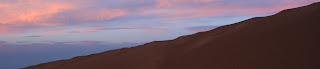


 Ive celebrated my last days here at


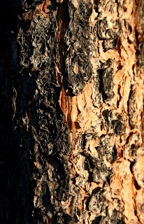


 The Squirrels certainly enjoy the immature cones that fall from the spruces! All are evergreens, all are conifers and all are in the pine family. COOL!

 We passed a lighter outcropping of rocks to the right- I spotted a larger green one out of the bunch. I picked it up to examine, and to discover
  Jan crawled over the long, rough
  We stayed there, behind the

 I saw no wildlife on the way into the park- the rangers station was closed. I would cut across the green mountain trail to the tonahutu; My plan was to walk over the continental divide, as I had yesterday, on the Tonahutu trail. I cut almost two miles off of my trip by driving to the green mountain trail. It would still surpass 17miles before I reached my destination (Bear lake).
 I passed a handful of campgrounds and the "Haynach lake, llamas permitted" sign.


 There was a nice column of dark smoke coming off of the valley FAR below me... I
 The bars zipped up to six when I glanced- only a quarter-mile towards Estes from where I had none. I made the calls, but neither of my poor parents answered their phones. The clock read 12:37.I shut the thing off and proceeded. The far side of flattop mountain (bear lake side) was still very Icy- the first one-fourth of the trip down was on snow.

